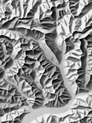
AI-driven Swiss-style Relief Shading
Swiss-style relief shadings are considered masterpieces of Cartographic design. Yet, the lengthy manufacturing process of such reliefs is only known to a few remaining experts. Hence, we trained an artificial intelligence (AI) to produce such shaded reliefs in mere seconds for arbitrary regions and in a quality that is indistinguishable from the original masterpieces.
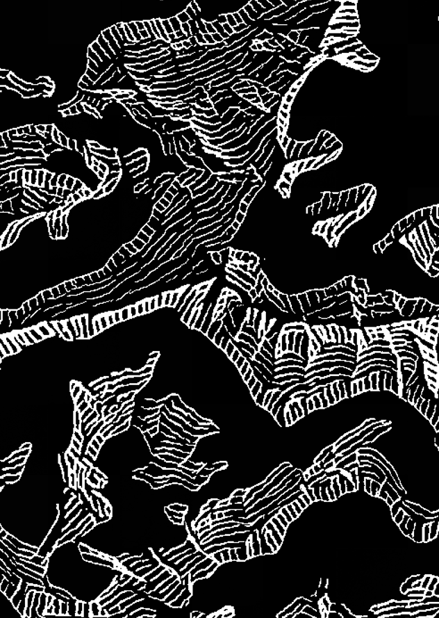
AI-driven Swiss-style Rock Depiction
Several approaches have been investigated to recreate iconic Swiss-style rock depictions by means of modern AI. This lead to two promising approaches based on diffusion models that can complement relief shadings: A rough drawing style that closely resembles the original hand drawn rock hachures and a smooth style that depicts rocks in a more even manner.
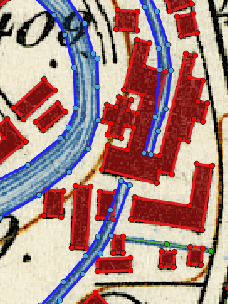
Automatic Vectorization
of Printed Maps
Switzerland has one of the most detailed and sophisticated map series in the world feature richness and positional accuracy is of high interest in many scientific fields. We developed workflows based of Artificial Intelligence (AI) and Geographic Information Science (GIS) to automatically extract and vectorize the depicted features.
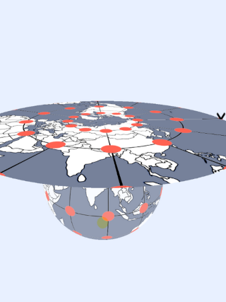
Interactive Tool to Construct Map Projections
This tool has been originally developed to help understand the geometrical construction of map projections. By interactively moving the three main components, the earth, the light source and the projection surface, it is possible to compose a large number of set-ups, each corresponding to a real-world map projection, many of which are in use today.
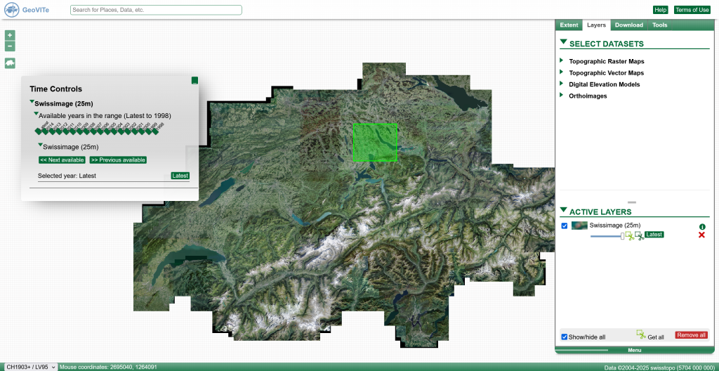
GeoVITe
Originally started as a Geoportal to improve teaching activities at ETH Zurich, GeoVITe is undergoing constant development to become a comprehensive management platform for research geodata with a strong emphasis on adhering to the FAIR (Findability, Accessibility, Interoperability, and Reuse) principles.